RowdyHacks XII: Military OSINT
A 150-point OSINT challenge: identifying a fighter wing from its aircraft markings and resolving its home station to the decimal coordinates the checker wanted.
Challenge
OSINT · 150 points. A photo of a military aircraft is provided, and a local checker asks for the base where it is stationed, as decimal latitude/longitude.
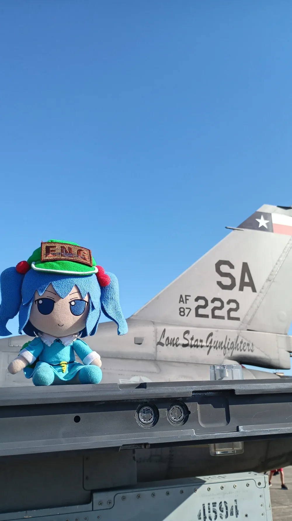 *The provided aircraft. Its markings were the thread that led to the unit and its base.*
Identification (public sources)
The aircraft carries a Lone Star Gunfighters marking, which identifies the 149th Fighter Wing of the Texas Air National Guard. Its publicly documented home station is Kelly Field Annex, Joint Base San Antonio-Lackland. This chain from unit to base is reproducible from open references about the wing's markings and basing; no private data is involved.
The checker input
The checker accepts a coordinate pair in latitude, longitude order. The pair a teammate submitted and that the checker accepted was:
29.38333, -98.58083A separately published airfield reference point (~29.3842, -98.5812) supports
the same location from public mapping; neither coordinate is claimed to be the
photo's exact capture point, only the station the challenge asked for.
Takeaway
Unit insignia, tail markings, and squadron nicknames are deliberately public, but in aggregate they fix a base and a mission, and a single captioned photo geolocates a facility entirely from open sources, the exact correlation an adversary runs. The OPSEC counter is to control imagery from sensitive sites and to assume any visible marking is collectable.
Flag
Spoiler: show the flag
rowdy{l0n3_st4r_gunf1ght3rs}