RowdyHacks XII: Passing Through
A 300-point OSINT investigation: geolocating a lift bridge in New Orleans and pulling eight facts, down to a federal case number, from public records.
Challenge
OSINT · 300 points. The challenge site supplies a full-resolution photo of a lift bridge and a checker that validates eight separate discoveries before releasing the flag.
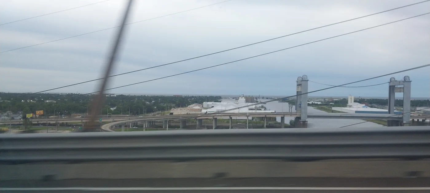 *The starting photo. The tower shape, the loop ramp, and the canal fixed it to the Danziger Bridge.*
Geolocation
The concrete towers, the loop ramp to the left, and the canal match the Danziger Bridge on US 90, seen from the I-10 High Rise Bridge looking north along New Orleans' Industrial Canal. A Louisiana DOTD notice places the bridge between France Road and Jourdan Road, and a road guide documents its France Road loop ramp.
From a warehouse to a court record
The warehouse behind the right-hand tower is Dupuy Storage & Forwarding, LLC. Dupuy's New Orleans location page lists 4300 Jourdan Road, New Orleans, LA 70126. That address appears in a federal case, Coex Coffee International v. Dupuy Storage & Forwarding, LLC, Civil Action No. 06-4798. Its pages give Warehouse No. 1 at 4300 Jourdan Road and report 1,495 coffee bags destroyed and 4,319 sold for salvage, a combined 5,814.
The eight answers
Danziger Bridge · I-10 High Rise Bridge · north ·
Dupuy Storage & Forwarding, LLC · 4300 Jourdan Road, New Orleans, LA 70126 ·
06-4798 · 1 · 5814
The checker reports "All eight discoveries verified" and shows the flag.
Takeaway
Each step was a public source, a bridge notice, a company page, a federal court PDF, chained from one photo into a precise facility, its owner, and its legal history, which is exactly how OSINT and due diligence work. The OPSEC counterpart is to assume a published image can be pivoted into records far beyond what the picture appears to show.
Flag
Spoiler: show the flag
rowdy{the_bridge_was_the_easy_part}